gempy.core.data.GeoModel
- class gempy.core.data.GeoModel(*, meta: GeoModelMeta, structural_frame: StructuralFrame, grid: Grid = None, geophysics_input: GeophysicsInput | None = None, input_transform: Transform = None, interpolation_grid: EngineGrid = None)[source]
Class representing a geological model.
Examples using
gempy.core.data.GeoModel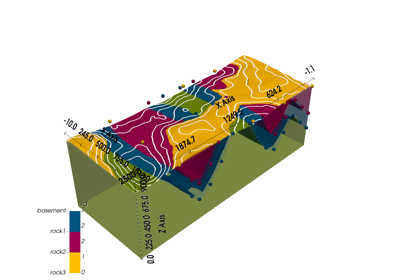
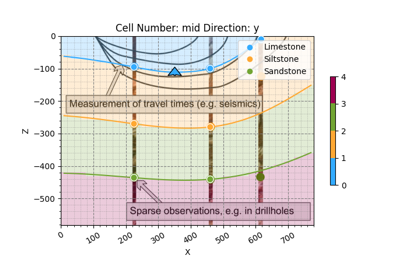
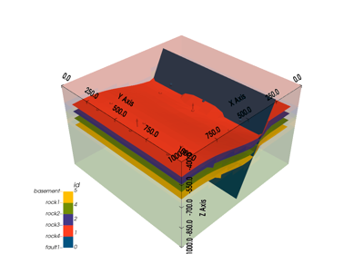
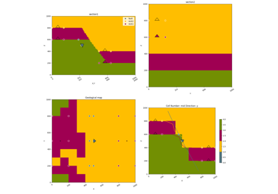
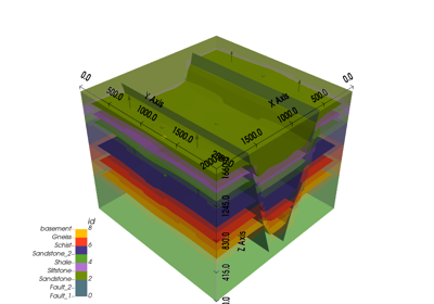
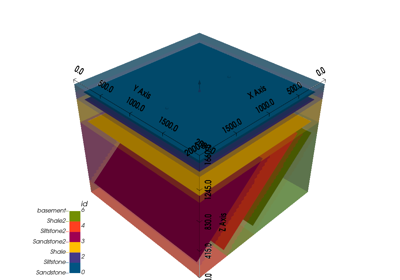
Video Tutorial “code-along”: Modeling step by step
Video Tutorial "code-along": Modeling step by step
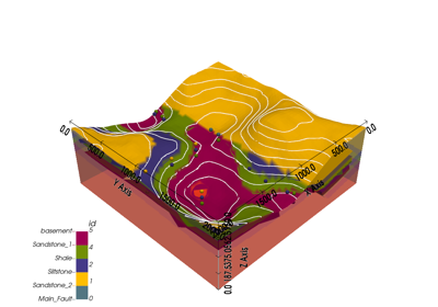
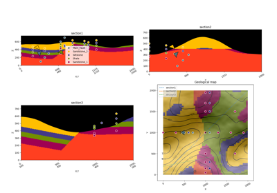
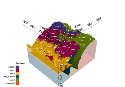
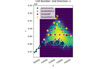
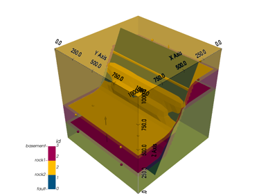
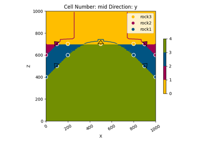
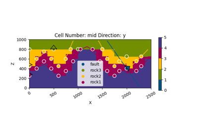
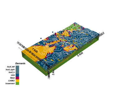
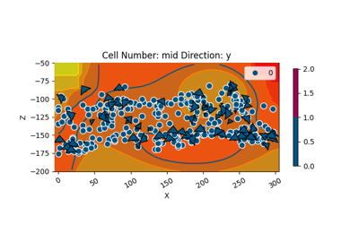
Unknown Model: Importing Borehole Data and Building a 3D Geological Model with GemPy
Unknown Model: Importing Borehole Data and Building a 3D Geological Model with GemPyMethods
__init__(**data)Create a new model by parsing and validating input data from keyword arguments.
add_surface_points(X, Y, Z, surface[, nugget])construct([_fields_set])copy(*[, include, exclude, update, deep])Returns a copy of the model.
deserialize_properties(data, constructor)dict(*[, include, exclude, by_alias, ...])from_args(name, structural_frame, grid, ...)from_orm(obj)json(*[, include, exclude, by_alias, ...])model_construct([_fields_set])Creates a new instance of the Model class with validated data.
model_copy(*[, update, deep])!!! abstract "Usage Documentation"
model_dump(*[, mode, include, exclude, ...])!!! abstract "Usage Documentation"
model_dump_json(*[, indent, ensure_ascii, ...])!!! abstract "Usage Documentation"
model_json_schema(by_alias, ref_template, ...)Generates a JSON schema for a model class.
model_parametrized_name(params)Compute the class name for parametrizations of generic classes.
model_post_init(context, /)This function is meant to behave like a BaseModel method to initialize private attributes.
model_rebuild(*[, force, raise_errors, ...])Try to rebuild the pydantic-core schema for the model.
model_validate(obj, *[, strict, extra, ...])Validate a pydantic model instance.
model_validate_json(json_data, *[, strict, ...])!!! abstract "Usage Documentation"
model_validate_strings(obj, *[, strict, ...])Validate the given object with string data against the Pydantic model.
parse_file(path, *[, content_type, ...])parse_obj(obj)parse_raw(b, *[, content_type, encoding, ...])schema([by_alias, ref_template])schema_json(*[, by_alias, ref_template])update_forward_refs(**localns)update_transform([auto_anisotropy, ...])Update the transformation of the geological model.
validate(value)Attributes
extent_transformed_transformed_by_inputinput_data_descriptorinterpolation_input_copyinterpolation_optionsmodel_computed_fieldsConfiguration for the model, should be a dictionary conforming to [ConfigDict][pydantic.config.ConfigDict].
model_extraGet extra fields set during validation.
model_fieldsmodel_fields_setReturns the set of fields that have been explicitly set on this model instance.
orientationsThis is a copy! Returns a OrientationsTable for all orientations across the structural elements
orientations_copy_transformedproject_boundsregular_grid_coordinatesregular_grid_coordinates_transformedsolutionssurface_pointsThis is a copy! Returns a SurfacePointsTable for all surface points across the structural elements
surface_points_copy_transformedtaped_interpolation_inputMeta-information about the geological model, like its name, creation and modification dates, and owner.
The structural information of the geological model.
The general grid used in the geological model.
The geophysics input of the geological model.
The transformation used in the geological model for input points.
ptional grid used for interpolation.
- meta: GeoModelMeta
Meta-information about the geological model, like its name, creation and modification dates, and owner.
- structural_frame: StructuralFrame
The structural information of the geological model.
- geophysics_input: GeophysicsInput | None
The geophysics input of the geological model.
- interpolation_grid: EngineGrid
ptional grid used for interpolation. Can be seen as a cache field.
- property surface_points_copy
This is a copy! Returns a SurfacePointsTable for all surface points across the structural elements
- property orientations_copy: OrientationsTable
This is a copy! Returns a OrientationsTable for all orientations across the structural elements
- model_post_init(context: Any, /) None
This function is meant to behave like a BaseModel method to initialize private attributes.
It takes context as an argument since that’s what pydantic-core passes when calling it.
- Parameters:
self – The BaseModel instance.
context – The context.
- update_transform(auto_anisotropy: GlobalAnisotropy = GlobalAnisotropy.NONE, anisotropy_limit: ndarray | None = None)[source]
Update the transformation of the geological model.
This function updates the transformation of the geological model using the provided surface points and orientations. It also applies anisotropy based on the specified type and limit.
- Parameters:
auto_anisotropy (GlobalAnisotropy) – The type of anisotropy to apply. Defaults to GlobalAnisotropy.NONE.
anisotropy_limit (Optional[np.ndarray]) – Anisotropy limit values. If None, no limit is applied.
- model_config = {'arbitrary_types_allowed': True, 'json_encoders': {<class 'numpy.ndarray'>: <function encode_numpy_array>}, 'use_enum_values': False}
Configuration for the model, should be a dictionary conforming to [ConfigDict][pydantic.config.ConfigDict].